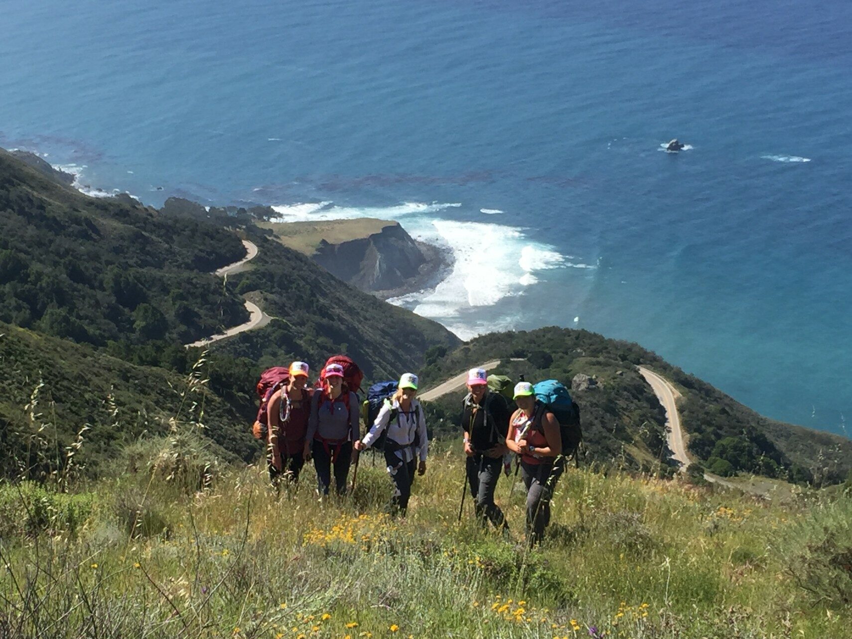

This time of year (early February) it’s pretty common to be thinking about future races. Races are great, but there are so many other adventures you can experience to get you out of your comfort zone (see Mental Toughness Series Part 2). I’ve always been a fan of getting out in nature, and backpacking is one of the best ways to do that, plus get a whole host of other benefits, like resetting your circadian rhythm and a nice technology detox.
Below are two options for backpacking Salmon Creek Trail in Big Sur, California. This night lapse someone took from Lion’s Den Camp will get you stoked to go here! Even if a trip to SoCal isn’t in your future, this itinerary can give you ideas on how to plan a backpacking adventure in your neck of the woods.
First, Some Resources
- Online Trail breakdown
- FORUM to check trail conditions
- Buy & bring: Big Sur/Ventana Wilderness map
- Trailhead: Park at Buckeye, just up the road off the highway from Salmon Creek Falls. Old ranger station denotes the spot. Don’t worry, it’s safe to leave your car there for a few days.
Itinerary Option 1
Long first day; easier days 2 & 3.
DAY 1 (Garmin file)
Buckeye –> Cruickshank: ~6.0 miles
Cruickshank –> Lion’s Den Camp: ~3.5 miles
Total elevation gain: 4,900ft+
Total: 9.5 miles
Water: Unreliable and/or iffy water at Lion’s Den; get clean spring water at Upper Cruickshank Camp intersection area before final ascent!
Difficulty: Hardest day! Long distance, hard climbing but with great views, some technical spots but nothing dangerous. Our trek was a little longer than what some resources may say because we took an offshoot trail to grab water at Upper Cruickshank.
Note: Lion’s Den is the high point of the SCT with great views and an amazing night sky.
DAY 2 (Garmin file)
Lion’s Den –> South Coast Ridge Road: ~0.4 miles
South Coast Ridge Road –> Salmon Creek Trail: ~0.3 miles
Salmon Creek Trail –>Spruce Creek Camp: ~3.7 miles
Elevation gain: 400ft (mostly downhill day)
Total: 4.3 miles
Water: Great flowing creek at Spruce Creek camp
Note: “Bushwhacking” as you descend (thick brush, wear long sleeves); you pass a campsite BEFORE hitting Spruce Creek… it’s nice, but Spruce is better so keep going 😉
DAY 3 (Garmin file)
Spruce Creek –> Salmon Creek Falls: 2.4 mile
All downhill, easy! Jump in the falls at the end, then hit the road.
Elevation gain: nada
Total: 2.4 miles
Note: Leave from camp early enough to make it home (or the hotel) by afternoon, no problem!
*All distances estimates based on what my Garmin tracked. It may be off by 1/4 to 1/2 mile but not too much.
Itinerary Option 2
Day 1 & 2 mileage more evenly spread out; easy day 3.
DAY 1 (Garmin file)
Buckeye (trailhead) –> Cruickshank Trail –> Villa Creek Camp: 6.4 mi
Total elevation gain: 3,000 ft
Total: 6.4 miles
Water: Villa Creek is a great water source right at camp
Difficulty: Moderate distance/hard first day, begins with climbing and great views, some technical spots but nothing dangerous.
Note: Villa Creek is just off Cruickshank Trail, there are signs. It is tucked in the forest/valley, gorgeous but dense and not great for star gazing.
DAY 2 (Garmin file)
Villa Creek Camp –> Cruickshank Trail –> South Coast Ridge Road: ~4.5 miles
South Coast Ridge Road –> Salmon Creek Trail: ~0.3 miles
Salmon Creek Trail –>Spruce Creek Camp: ~3.7 miles
Total elevation gain: 3,300ft+
Total: 8.5 miles
Water: Great flowing creek at Spruce Creek camp for water.
Difficulty: Moderate distance/moderate difficulty, some technical spots but nothing dangerous. Solid climbing first half; downhill second half.
Note: ”Bushwhacking” as you descend (thick brush, wear long sleeves). Stop at/near Lion’s Den for lunch and views. You will pass a campsite BEFORE hitting Spruce Creek… it’s nice, but Spruce is better so keep going 😉
DAY 3 (Garmin file)
Spruce Creek –> Salmon Creek Falls: 2 miles
SC Falls –> Buckeye (car): 0.3 miles
Total elevation gain: 720ft
Total: 2.3 miles
Water: Plenty at the falls but not necessary—you’re done!
Difficulty: Mostly downhill, easy.
Note: Take some time to jump in the pool & relax under the waterfall—cold but worth it! Leave from camp early enough to make it home (or the hotel) by the afternoon, no problem!
*All distances estimates based on what my Garmin tracked. It may be off by 1/4 to 1/2 mile but not too much.